Don't get bored at bus stops
2003/02/25 Atxotegi Alegria, Uhaina - Elhuyar Zientziaren Komunikazioa

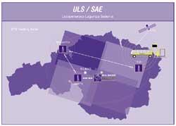
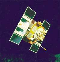
The Global Positioning System, called GPS, receives the signal from several satellites to locate exactly one object, in this case a bus. The orientation and navigation system is complex: The information is sent by a network of 24 satellites at 20,000 kilometers above Earth.
Buses carry a GPS receiver. This receiver can receive signals emitted by three satellites, process them and provide the bus position. The problem arises when the bus does not receive the signal from satellites, for example, in tunnels or narrow streets. In urban areas, GPS coverage is 50-60%, so other measures are adopted.
Location of the bus
To know the exact location of the bus, in addition to the GPS system there are two other methods: on the one hand, they measure the number of turns that the wheels give to determine the kilometers traveled and the place in which it circulates; on the other hand, each time the bus opens the doors takes into account this information, since when opening them, the computer measures the distance traveled up to that moment and compares it with what theoretically should do. This information only serves to confirm the above.

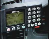
All this information is collected in the control and once processed is represented on a map. Each image is renewed every 20 seconds. Control computers constantly ask where the buses are and the image is automatically renewed. In this way, if at any time there is a disaster or change, the buses can be reorganized. The bus driver may be informed in writing or via radio of the change to be made.
Forms of user information
There are two ways of information to the user. On the bus there are screens that report the following stops and when the bus will arrive at the stations. In addition, customers who wish will be sent SMS phone messages when a problem arises and can be consulted through the Internet.

Gai honi buruzko eduki gehiago
Elhuyarrek garatutako teknologia


