
Footsteps deeper than dinosaurs
2002/11/10 Carton Virto, Eider - Elhuyar Zientzia
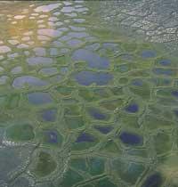
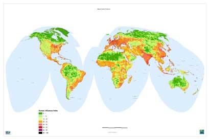
The American environmental organization Wildlife Conservation Society has represented on a map the influence of man in all areas of the Earth. They have not taken into account the sea, nor many small islands located in the center of Antarctica and the ocean, but the result is not negligible: the data indicate that in 83% of the earth's surface we have left our mark, that is, the forests of Alaska, Canada and Russia, the highlands of Mongolia and Tibet and the extensive regions of the Amazon everywhere. In addition, 98% of the land suitable for planting rice, wheat and corn is already exploited.
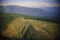
From the Industrial Revolution to the 20th. In the 20th century, human beings have transformed nature more and more quickly. Before the Industrial Revolution, the transformation capacity of nature was limited by human and animal physical force, but today a bulldozer is enough to replace the force of 300 horses. To understand the violent change of the environment, it is enough with XX. look at the photos from the beginning of the century or ask grandparents. Or look at what he had in his childhood near home and what is now.
Studies in recent years have shown that we assume 40% of the organic matter generated annually by the land and 35% of that produced in the sea, using 60% of the freshwater that is on the ground. Thus, if every inhabitant of the earth consumed the same as a normal American, it would take four Earth planets to supply us. It is true that Americans are the most consuming, but we are not far away. Click here at the internet address, responding to the survey, you will be able to know how many planets would need 6,000 million people like you. I, for example, should consume less than half to be sustainable.
Map that has come hand in hand with technological advances
Twenty years ago it would have been impossible to develop such a map, since, despite the available data, there was no adequate tool for its management. Members of the Wildlife Conservation Society have worked together with four stakeholders: population density, land transformation, communication infrastructure and electrical infrastructure. The latter, for example, have been able to know about the photographs of the Earth taken by the satellites, taking photos of the night and analyzing where the lights were and the intensity of them. Thanks to satellites, the collection of geographic data is now much easier and thanks to computer technology it is possible to manage them efficiently. In this case, 9 data sets from different international organizations have been extracted which are necessary to complete the map.
All agents have been combined and scored between 1 and 100. 100 for those who had the deepest human footprint and 0 for those who had saved. Points have also taken into account the ecological character of each region, as the same agents leave a different mark on U.S. forests and rainforests.
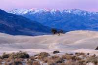
100 points have been assigned to a single area, the city of Brownsville, in Texas, but aside from this exception, its head has become the list of the largest cities in the world. New York, Mexico City, Calcutta, Beijing, Durban, Sao Paulo, London... appear among the top of the list, while the last appear the boreal forests, the deserts of Africa and Australia, the Arctic tundra and the Amazon, virtually uninhabited regions.
Members of the Wildlife Conservation Society believe that such maps do not only serve to become aware but also to design local management plans. Although the data they have collected are limited and large-scale, they have considered a good starting point. In fact, regions that are still wild among human feet have been identified. 568 sites have been classified in the list of ‘final wildlife areas’, representing as best as possible the existing ecosystem sets on earth. Some have more than 100,000 km2, others just 5, but where they have started.
Published in 7K.

Gai honi buruzko eduki gehiago
Elhuyarrek garatutako teknologia