Volcanic activity by satellite
2002/09/01 Elhuyar Zientzia Iturria: Elhuyar aldizkaria

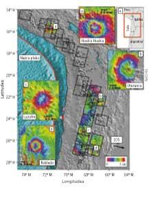
Analyzing satellite data, the geophysics of the California Institute of Technology have identified the four most active volcanoes in the Andes. The data were collected by two ESA satellites (ERS 1 and 2) between 1992 and 2000 using radar interferometry. In total, 900 of the 1,100 volcanoes classified in the Andes have been analyzed.
Through this method, surface variations of volcanoes have been measured without the need to move. For this purpose, they have measured the time between the shipment and the return of the radar signal. When the satellites go back to the same place, a new measurement is made indicating a surface change if the time is different. These modifications are a consequence of volcanic activities: lava discharges, earthquakes, underground magmas or land movements by water, etc.
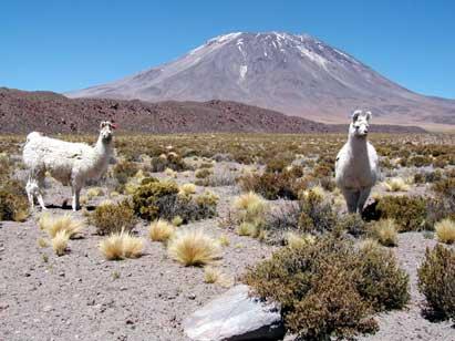
In this way, it has been observed that there have been no changes in 50 potentially active volcanoes, while in another four deformations have been observed: The Peruvian volcano Hualca Hualca grows 2 cm a year (exploded again in 1990); the Uturuncu of Bolibia grows 1-1,5 cm a year; the place known as Lazufre between Argentina and Chile grows 1 cm/year; and the Caldera Robledo argentina has grown 2-2,5 cm/year.

Gai honi buruzko eduki gehiago
Elhuyarrek garatutako teknologia


